
Hole-in-the-Rock
Originally published in Overland Journal Winter 2008
— Modern expedition vehicles tackle the trail built for Mormon wagons 125 years ago.
"...the roughest country you or anybody else ever seen; its nothing in the world but rocks and holes, hills and hollows. The mountains are just one solid rock as smooth as an apple."
So the words of Elizabeth Morris Decker came to me deep in the Utah desert where the road came to a steep slickrock climb. She had been on the original Mormon San Juan Mission, and could well have written those words to her parents right where I was engaging the clutch in my Land Rover. The 300Tdi chugged confidently as we hit the bottom of the slope, in low range first, the slickrock towering before us at a frightening angle. It was a confidence that I did not share. The slope stretched up, and looked like 45 degrees, though I knew that it was probably more like 32! Climbing the slick rock wasn’t really the worry. The one-and-a-half foot deep trench parallel to the slope that we had to cross while ascending was the worry. Chugging slowly up, I picked my line keeping in mind that my wife in the passenger’s seat hates all things to do with steep angles. The driver’s side front wheel crossed the trench with a lurch, and then the rear wheel went in. Unfortunately not across, but down into the trench, and the passenger side front lifted smoothly into the sky as the rear groaned and dropped.
From inside it felt like we were going to go back down the slope the hard way! Connie’s gasp urged me to stand on the brake to stop all motion. The passenger front was a good three feet in the air and we were now no longer parallel with the ascent. Calmly as I could, I radioed for Josh to come and have a look-see!
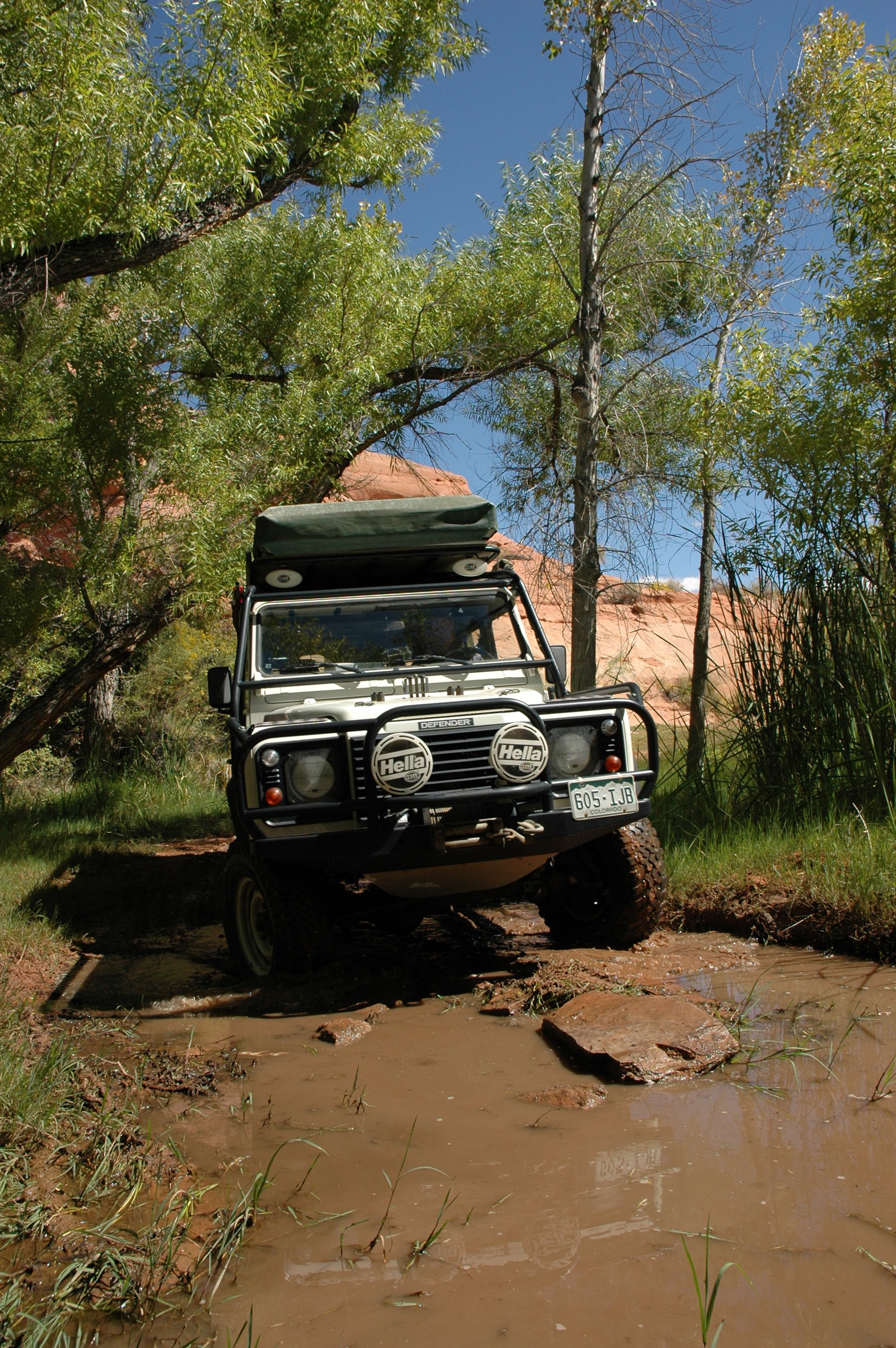
This situation wouldn’t have been that hair-raising but for a few details; my Defender 110 weighs 6900 pounds and with a full roll cage, an overbuilt roof rack and a roof-top-tent, much of that weight was much higher up than I would like. So traversing slide slopes of any significance was something of a worry. Also, we were a good 20 miles into the Hole-in-the-Rock trail in Southern Utah, a full days travel on a track that is both challenging and remote, and, therefore, far from help. Well, I cannot lie, Josh had cell phone service where my Defender was doing its tail stand, but even so, help would be a long time in coming. Given our somewhat precarious balancing act, I was not giving much thought to the trip out, but the descent off Grey Mesa would be just as harrowing if not more so!
Five of us had converged just after dawn at a small coffee shop in the town of Monticello two days previous. Connie and I had planned on making it to the trail-head and camping there on Friday night, but Connie was trying to suppress an insurgency in her stomach, so we got a hotel in Monticello. Josh, in his Discovery, had left Denver behind us and had caught a few hours sleep in the parking lot of the Moab airport before continuing his journey South. Neal, with his Jeep Rubicon Unlimited, was already in Moab, and just had to make the early trek down to meet us. Originally there were supposed to be more, but several groups had dropped out at the last minute. The trip had been arranged online on the Expedition Portal forum, and there was some confusion about what the ‘actual’ Hole-in-the-Rock trail was, and, therefore what part we would be doing. So let me digress with a little history.


In April 1879, a group of Mormons started an expedition heading East from Forty-Mile Spring south of Escalante Utah, in an attempt to found a new settlement on the Eastern side of the Colorado River. The San Juan Mission, as it was called, was heading into little known and very wild environs, but they had elected to take a short cut instead of using a previously scouted route. Their first obstacle would be the descent to the Colorado River. The pioneers camped at Fifty Mile Spring and spent the next six weeks blasting a road through a narrow crack and down a near-vertical cliff face to the river 1200 feet below. After they had made the ‘hole’ navigable, they descended to the river in an operation vividly described by Decker through what would become known as the Hole-in-the-Rock:
“If you ever come this way it will scare you to death to look down it. It is about a mile from the top down to the river and it is almost straight down, the cliffs on each side are five hundred ft. high and there is just room enough for a wagon to go down. It nearly scared me to death. The first wagon I saw go down they put the brake on and rough locked the hind wheels and had a big rope fastened to the wagon and about ten men holding back on it and then they went down like they would smash everything. I'll never forget that day. When we was walking down Willie looked back and cried and asked me how we would get back home."


At the bottom of the descent, the forty wagons and 256 people were borne across in a ferry built by Charles Hall. Once on the eastern side of the Colorado, the going got slightly easier, but the terrain was still incredibly rugged. On what was supposed to be a six-week expedition, they reached their goal on the San Juan River six months after leaving and founded the settlement of Bluff at their stopping point. Bluff eventually spawned other colonies including Blanding, Monticello and Verdure.
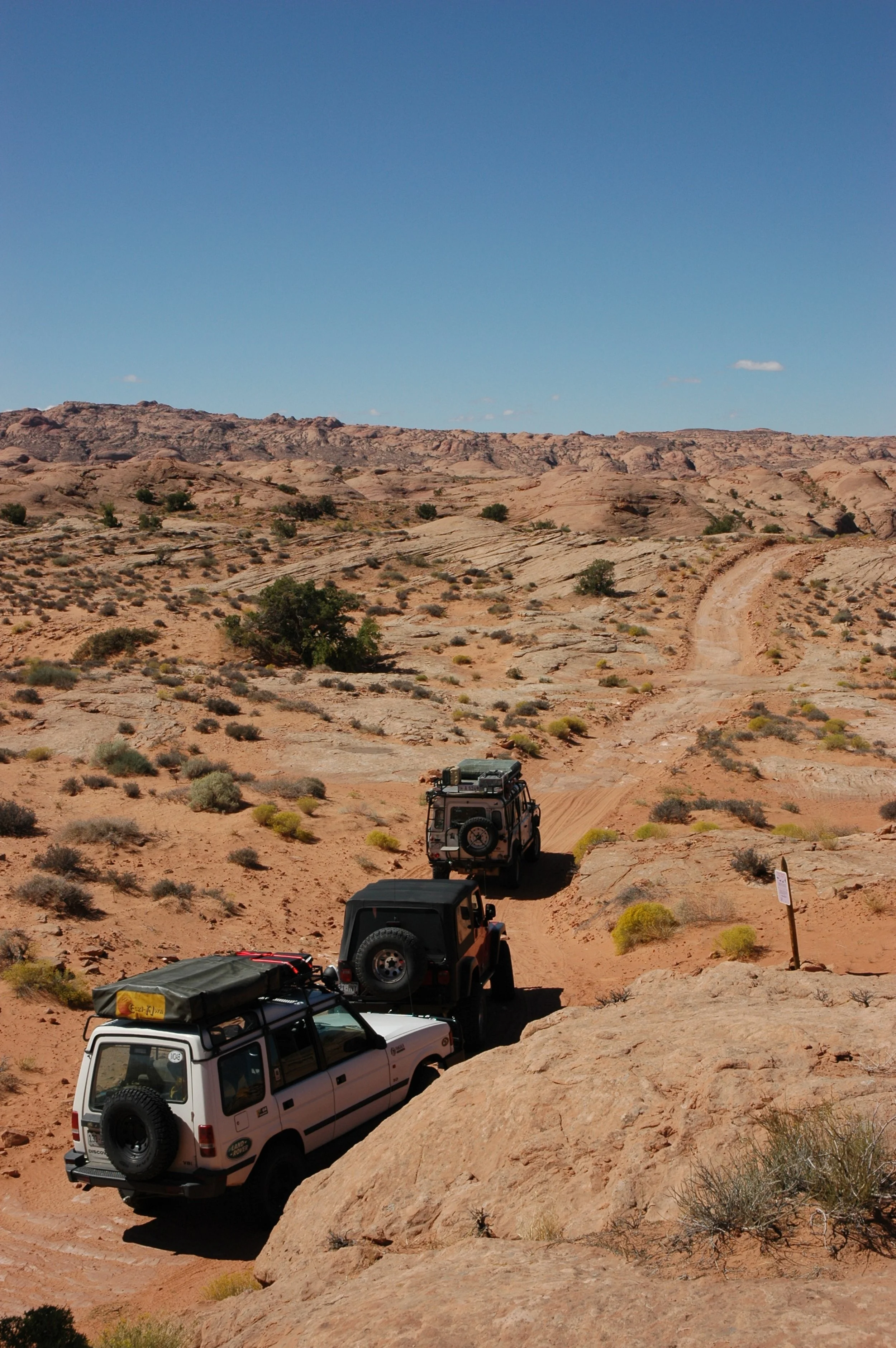
Today Lake Powell bisects the Hole-in-the-Rock route where the Colorado River used to, and some 300 vertical feet of the trail are now under water. On the western side, from the junction with Highway 12 close to Escalante, the Hole-in-the-Rock road leads 62 miles to the Hole-in-the-Rock itself. This road is navigable by two-wheel drive vehicles so long as it is not saturated. On the eastern side of Lake Powell the trail becomes very rough and can only be accessed by well-prepared four-wheel drives. This segment goes from the lake to Highway 276 fifteen miles east of Halls Crossing. It is a 25-mile one-way journey, from the highway to the end of the trail, and this is the section we were attempting. For simplicity sake, I refer to this as the Hole-in-the-Rock trail rather than the Hole-in-the-Rock road on the western side.


Halls Crossing is the last place for fuel and supplies before attempting the trail, and leaving Halls Crossing after fueling up, we headed for the small airstrip that marked the start of our off-road adventure. Initially the road was a surprise; the track had been recently bulldozed, and some sections of slickrock had seen the application of a rock grinder. Soft sand was interspaced by rock, but the trail was easy to follow, and we had no real need for the waypoints I had found on the internet. We paused at a USGS survey marker to get our bearings and take a look around. The trail to this point had been easy, and I wasn’t expecting it to change much, but I couldn’t have been more wrong. In many years of 4-wheeling, I don’t think I have driven a road that varied so much over its course. From soft sand to hamada, to slickrock, to regular gravel roads the trail meandered through a vast expanse of red Utah desert with the unseen promise of Lake Powell at the other end. We traveled slowly, having no real deadline, and enjoyed the vast scenery and the quiet. Well, quiet when the diesel was off.
Several miles into the route we took a small detour up a canyon that led to several enclosed campsites under overhanging rock faces. Lunch was taken at the end of the track, and we decided that it was too early to make camp. Up to this point we had seen no one else on the trail, but this changed shortly after lunch when we came across two nicely prepared Hummer H1s heading back the other way. They asked if we intended to ‘go all the way’ and on our affirmation, gave a sad smile I was to remember later! The land was rising steadily, and eventually we came to a section of soft sand that made the track through growing canyon walls. In truth the canyon wasn’t very deep, but it was narrow, and one large ledge obstacle gave a taste of what was to come. We met some ATVs coming the other way at the ledge, and we could hear other people in the hill at their camp. I’m not one to choose camping close to others, but unfortunately we ended up with no choice. Shortly after the ledge we reached a large sign announcing the ascent up on to Grey Mesa. This part of the trail didn’t follow the Mormon route, but rather, made a more car-friendly track up the mesa edge. As we arrived at the bottom, the ATV riders told us that there was a large group coming down off the mesa. We stopped and had a look around on foot. The lower part of the trail was rough, but looked fine. Josh and I hiked the original Mormon route for a span, marveling at the effort they went to to allow the descent. In several places they had carved steps into the rock and grooves around off-camber corners to guide wagon wheels. It was already late in the afternoon by the time the first of the descending group got to us, and an hour later before the last past. We decided to make camp at the foot of the Grey Mesa where the light faded early due to the high cliffs surrounding us.


Going up onto to the Mesa was somewhat hair-raising. It is a high shelf-road with some very tricky ledges to climb. The largest ledge tips the car out towards the precipice at an alarming angle but with the right line and enough traction, is quickly passed. Once on top of Grey Mesa, the trail becomes a regular dirt two-track, and is calmingly smooth! The view off Grey Mesa is superb, giving excellent vantage over the San Juan River as it meanders to Lake Powell. We stopped for photos and to transfer fuel into Neal’s Jeep.
Coming off the far side of Grey Mesa the trail went back to its old ways and found slickrock. This is where we came to one of the few named obstacles on the trail. Called “The Chute”, it is a long, steep descent through a slickrock gulley with towering walls and an uneven, undulating, narrow floor. Neal made short work of the chute, his Rubicon Unlimited looking very stable on the descent. Josh followed and was doing well until he misjudged the position of a deep hole in the rock. The passenger front wheel of the Discovery found the hole and promptly vanished, shoving the opposite rear wheel into the air! The bull bar stopped all forward action, and for a short while Josh hung suspended before we guided him out. I brought my Defender down the chute last, but managed to save all drama for the upcoming climb.


So that is how Connie and I found ourselves in an almost upright Defender teetering too close to doing over and down. Of course, these things are always worse from inside the car, and after some judicious checking, and with Josh perched on the bulbar we managed to back down the slope.
Connie’s answer to my query “Shall we try again?”, was met with a frosty glare, and so we abandoned the Defender at the bottom of that climb, and went up the old fashioned way, all the while marveling at how steep it was. At the top Josh was kind enough to give us a lift to Lake Powell!
The navigable part of the trail ends a fair distance from Lake Powell. From there a hiking trail follows the rest of the route as it begins the descent to what was then the Colorado River. The beginning of the hiking trail is indicated by a marker, and we followed the trail for a good distance to get a view of the lake. The scenery is jaw dropping with huge vistas over rugged, red slickrock, and the navy glint of the lake beyond. Thin white traces raced on the lake showing the heavy boat traffic, but up on the escarpment we could hear nothing but the wind.


After taking the obligatory “we were there” photos, we turned the Rubicon and the Discovery around and went back to collect the Defender. By this time it was getting well on to time to find a camping spot. Just as the trail turned left and started the final climb back on to Grey Mesa, we found a tree and some well placed slickrock to make a home for the evening. It is a blissful solitude that settles on such places after dark, an air of calm, which after a hard day on the trail, becomes doubly magical. Connie made an African evening of it by preparing borewors on the braai with pap and breede, a meal that always goes down well with me. Neal decided to try to make a bed in the back of the Rubicon, and, reported comfortable rest, his head sticking out under the stars.
Our first task of significance the next morning, and one I had already devoted much thought to, was the descent off Grey Mesa, and that one nasty step that would kick 6900 pounds of Defender out towards a several-hundred-foot drop. Feeling blithely confident, and with Connie determined not to let fear get the better of her, we started down. Being first in line, I was scarcely aware of Neal’s alarm over the radio as the Defender went down the step. The right rear came off the ground and for an instant we were in the reverse position from the previous day, the drivers side front suspension fully compressed, the wheels turned in and open space facing us. Did I mention that the step was on a corner? And then, with the inevitable assistance of the gravity winch we came down and lumbered to the foot of the Grey Mesa. That small section gave my confidence in the Defender’s ability a massive boost.


From the foot of the Mesa the journey back to Highway 128 was uneventful and easy. With a nice stop for lunch and plenty of photo pauses, we made a slow day of it. As we approached the highway we took a detour that bypassed the airfield and took us passed an old halftrack armored vehicle stripped by the side of the trail. Once on the highway, we retraced to Halls Crossing, and continued on to Lake Powell. I highly recommend taking the ferry from Halls Crossing to Bullfrog at the end of a Hole-in-the-Rock expedition. The ferry leaves regularly and the short ride is both relaxing and scenic while offering welcome cool temperatures after the heat of the desert.
Trip Planning:
Due to the remote location of the trail, supplies need to be well thought out before attempting it. We planned for three full days on the trail, so all water, fuel and food had to be accounted for. Halls Crossing has a fuel station, and that is the last stop before the trail, and the first stop after! Neal’s Rubicon Unlimited had the most limited range, so I had a jerry can of fuel on board for him. Josh also had a jerry can, just in case. We all had extra water, food, and were prepared for a relaxing and slow-paced expedition.
Turning off the highway to access the trail can be somewhat confusing. Easiest is to take the track directly to the west of the small Halls Crossing airfield. There is another track further east down the road that leads to the trail, and we used that on the way out, but it can be somewhat hard to find on your first drive in.